The Beers map can be found on the internet at davidrumsey.com and is displayed below.
The Beers map is especially nice because it lists who lived in each house. The main problem is that it pre-dates the final reservoir by almost 50 years, so there are things on the peninsula that don’t appear on the map. Even for places shown on the map, the last occupants of the home may have been different than those listed on the map. Also, since the map pre-dates the earlier reservoir, Lake Kensico, changes to the town caused by the creation of that first reservoir are not shown.
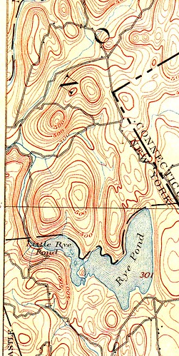
The topographic map was better in that it was from 1899 when Lake Kensico existed, and it shows a few buildings and elevation changes, but it didn’t seem to include every building, doesn’t include names, and was difficult to read due to the scale. The northwestern-most north-south road near the top of the map is the road running down the peninsula. The town center was at the southwestern end of that road, just off the map. Today's NY-22 bridge over the reservoir crosses the small stream from Rye Pond southeast of the T-end of the peninsula road.
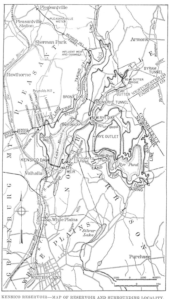
I later found a great map (below) from the NYC Board of Water Supply reports that includes the old Lake Kensico, roads, new reservoir, and temporary reservoir. This helped a lot in explaining some of the old photographs and to further clarify locations on the peninsula.
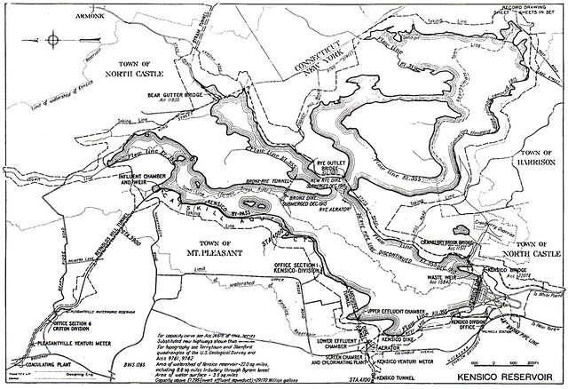
A 1916 map from the Board of Water Supply shows the now complete reservoir with submerged temporary dikes and pipeline as well as the aqueduct location and bridges.
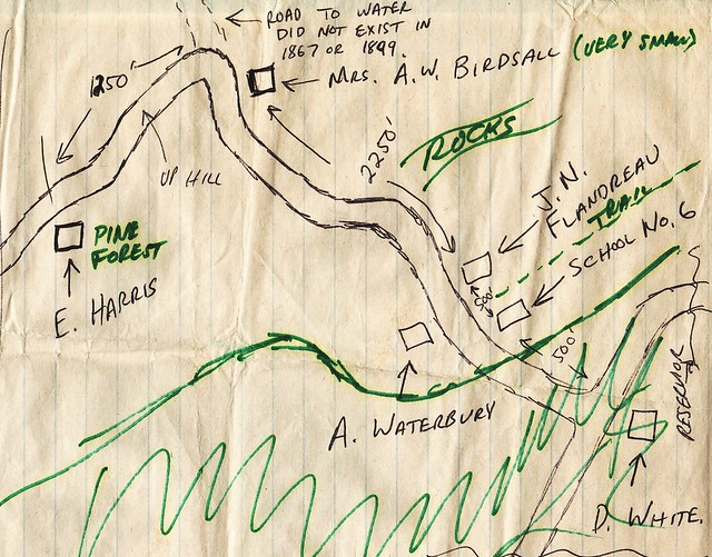
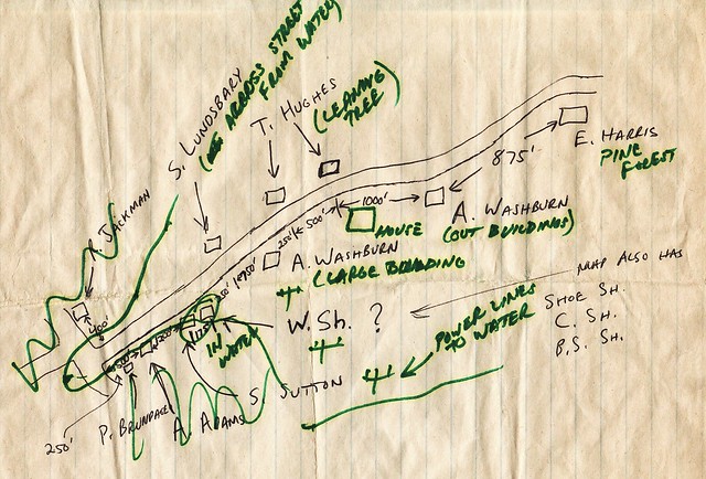
My hand drawn maps are below, the first map shows the northern end of the peninsula (north is to the right) and the second map shows the southern end of the peninsula. The items in black ink are based on the Beers and USGS maps. The items in green are field observations added while exploring the peninsula.
Text and Hand Drawn Maps Copyright 2013 by Robert Mortell