Home > NYC Reports > 1916
The new Kensico Reservoir reached its full capacity at 40 billion gallons on May 23, 1916. While the reservoir filled, design work continued on the architectural details for the stone and brick work on the upper and lower pavilions and fountains, doors, windows, and grilles. About 3 miles of road on the west side of the reservoir was paved, wire fences were erected, and additional trees were planted around the reservoir during the year. The north approach to the Rye Outlet bridge on NY 22 was also paved.
Engineering work progressed to determine the best way to light the roadway across the dam. The city worked with GE both at the dam and in Lynn, Massachusetts where GE built a 50-foot long full-size model of the roadway. They found that placing lights with reflectors in the walls lit the roadway without blinding drivers or pedestrians. When I was a child these light fixtures could still be seen although they had been broken and vandalized long ago. At some point later they were sealed with concrete, but the outline of these lights is still visible.
On the dam, the last of the finishing stonework and concrete masonry was completed. In addition, the pavilions, terrace, and pools received their final stone and masonry work. On the plaza, the new roadways were graded and paved. Inside the dam, the inspection wells were monitored as the water level rose to ensure no leakage through the contraction joints. Only two joints showed any leakage, and were repaired.
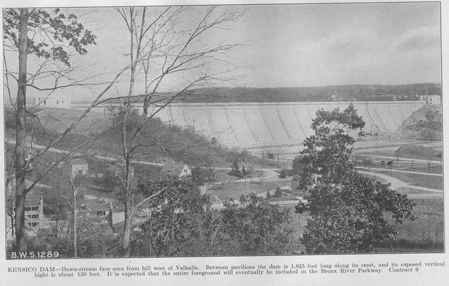
This is essentially the view I had of the dam from my bedroom window when I was a child. The New York Central Harlem Division tracks can be seen at the bottom of the picture, but the parkway does not yet exist. Plans were underway for the construction of the Bronx River Parkway at this time and it was expected the parkway would occupy most of this lower area.
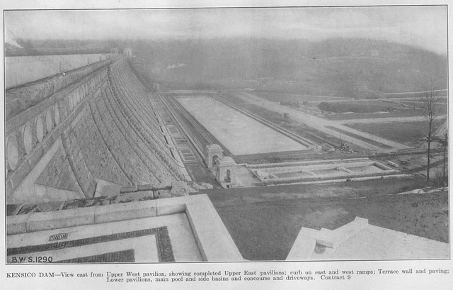
Looking at the face of the dam, terrace, pavilions, and pools from below the upper west pavilion.

Kensico Bridge at the east end of the dam over the spillway was largely completed in 1916, including the brick paving which was completed in October. The short section of roadway between the bridge and dam was also completed except for the brick paving. The picture above is looking east with the now closed “East Hill Drive” in the foreground (covered by a railroad track) and NY 22 in the background. East Hill Drive has been closed to traffic for as long as I can remember, but I used to walk the old brick road often as a child. During 1916 the concrete foundation and edging for West Hill Drive was laid as was the brick. This road was also closed for as long as I remember, and was mostly obliterated by the redesigned West Lake Drive at the top of the dam (to eliminate the sharp curve when coming off the dam) and by the Holy Name school at the bottom. I still managed to walk it a few times though.
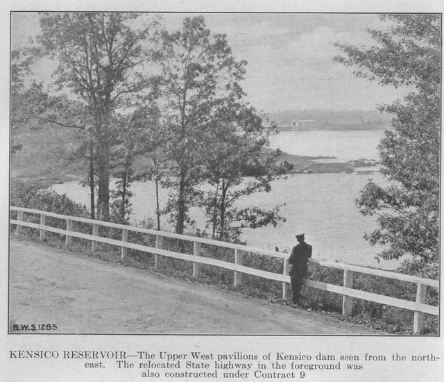
Looking at the reservoir from the new NY 22 with the dam in the background.
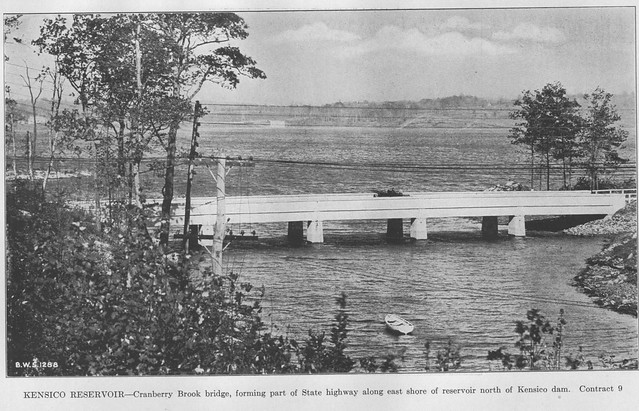
Another view of the reservoir from the east with the Cranberry Brook Bridge on NY 22 in the foreground.
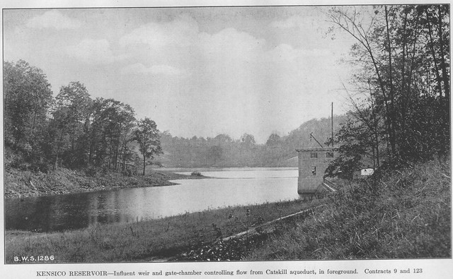
The buildings at the influent and upper and lower effluent on the west side of the reservoir were at various states of completion during 1916, with the influent and upper effluent buildings still lacking their concrete roofs. The valves and sluice gates were installed and tested, and the heating system at the lower effluent chamber was installed.
While the reservoir filled work continued to remove all tree stumps, roots, and other plants from the reservoir area. Above the reservoir level orchards including apple and wild cherry trees were removed and replaced with planted conifers. Stone walls were removed to within 100 feet of the eventual water level. Before being inundated by the rising water, the temporary gate house, footbridge, and trestle were removed at New Rye Lake, the temporary reservoir for the Williams Bridge section of the Bronx formed by Rye Dike. The trestle crossed the temporary reservoir and can be seen on one of my postcards of New Rye Lake.
Home | 1915 Report | 1917 Report | Site Map
Synopsis written by Robert Mortell, 2013.