Home > NYC Reports > 1908
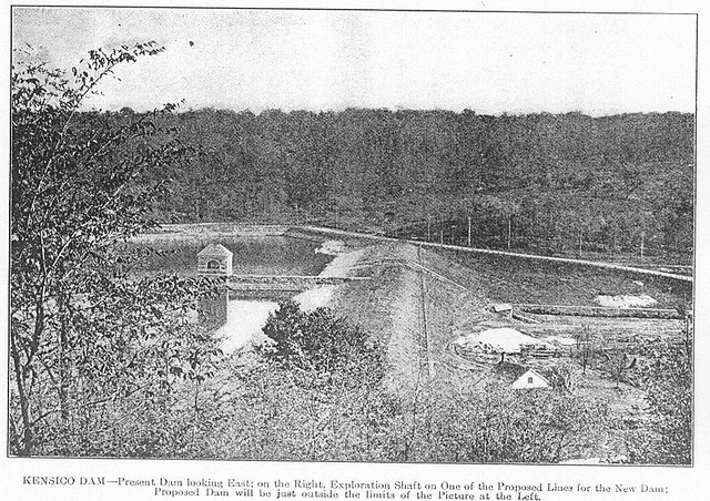
By 1908 planning was well underway for the new Kensico Dam and Reservoir. The City was actively acquiring the property that would become the new reservoir. Tests, surveys, and maps were being made to site the temporary dikes, the future Kensico Dam, the NY-22 bridge over the new reservoir, and to relocate what would eventually become NY-22. Early in the year the decision was made to site the new dam about 500 feet behind the existing dam. This was a change from the 1907 plan which called for building the new dam in front of the old 1885 dam, allowing for an uninterrupted water supply for the Williams Bridge section of the Bronx, and resulting in the old dam remaining at the bottom of the new reservoir. Although this change required draining the existing reservoir and building a temporary reservoir, tests both in front of and behind the 1885 dam including underwater tests indicated the superiority of the northern site. To drain the old Lake Kensico two temporary dikes were built. The New Rye Dike sat just west of the current NY-22 bridge on Bear Gutter and the stream from Rye Ponds and formed the temporary reservoir. The other was placed on the Bronx River in the valley west of the current peninsula. The water from the Bronx River was then also piped into this temporary reservoir. A 36-inch pipe from the new reservoir then carried the water to the existing pipeline downstream of the old dam. Once the new dam was complete, a gate chamber in the center of the dam would connect to this pipe, called the Bronx Conduit. Most water however would exit the new reservoir through the aqueduct about a mile northwest of the dam.
The 1885 dam, looking east. The new dam will be just outside the picture on the left.
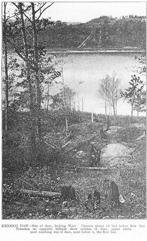
The proposed site for the new Kensico dam, cutting through Lake Kensico. The trenches mark the faces of the dam. The top white post marks the top of the dam, while the two posts below it mark the future level of the reservoir. The location of the photographer is about 15 feet underwater today.
The full 1908 report can be found on line at archive.org.
Home | 1907 Report | 1909 Report | Site Map
Synopsis written by Robert Mortell, 2013.